 Safekipedia
Santa Monica Mountains
Adapted from Wikipedia · Discoverer experience
The Santa Monica Mountains are a beautiful coastal mountain range in Southern California, close to the Pacific Ocean. They are part of something called the Transverse Ranges. Because they are near many big cities, lots of people visit these mountains every year to enjoy the nature and fresh air.
The Santa Monica Mountains National Recreation Area works to protect most of this mountain range and sometimes goes a little beyond it. This helps keep the land safe and beautiful for everyone to explore and enjoy.
Geography
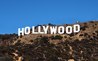
The Santa Monica Mountains stretch about 40 miles (64 km) from the Hollywood Hills in Los Angeles to Point Mugu in Ventura County. These mountains separate areas like the Conejo Valley from Malibu and form a barrier between the San Fernando Valley and the Los Angeles Basin. They are next to other mountain ranges and have many houses, roads, and places to visit.
Several creeks in the Santa Monica Mountains are part of the Los Angeles River watershed. The river starts in the San Fernando Valley and flows around the eastern end of the mountains.
Archeology
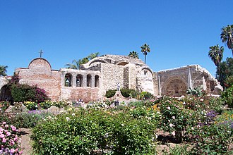
The Santa Monica Mountains hold over 1,000 important places from long ago, used by the Tongva and Chumash people for thousands of years. Their lives changed greatly when the Spanish mission system arrived.
Geology
Geologists think the northern Channel Islands are a part of the Santa Monica Mountains that extend into the ocean. The mountains were formed by movements along the Raymond Fault, creating layers of rock that sometimes contain fossils. There are also areas of volcanic rock, including "Sandstone Peak," the highest point at 3,111 feet (948 m). Malibu Creek runs through the middle of the range.
Climate
The Santa Monica Mountains have dry summers with ocean fog on the south side and cooler, rainy winters. Because of the dry summers, wildfires can happen, especially when strong winds blow.
Snow is rare in these mountains. In January 2007, snow fell in the hills above Malibu for the first time in fifty years. Snow has also been seen on Boney Peak in recent years, and in February 2019, snow appeared in some lower parts of the mountains.
Wildfire
When dry conditions, wind, and terrain come together with a spark, big wildfires can happen in the Santa Monica Mountains. These fires can destroy plants and homes. In 2018, the Woolsey Fire burned a large part of the area, and a plan was made to help the land grow new plants and trees.
Protected areas
Much of the Santa Monica Mountains is inside the Santa Monica Mountains National Recreation Area. Many groups help care for these lands, including the Santa Monica Mountains Conservancy, the National Park Service, the California State Parks, and local government agencies.
The Santa Monica Mountains are popular for both living and visiting. Over twenty parks are found here, such as Topanga State Park, Leo Carrillo State Park, and Malibu Creek State Park. The Satwiwa Native American Indian Culture Center in Newbury Park, California is also part of this area.
At the eastern end are Griffith Park and Elysian Park. A big trail called the Rim of the Valley Trail is being planned to connect many parks and natural areas around the valleys nearby.
Flora and fauna
The Santa Monica Mountains are home to many different animals and plants. You can find mammals like mule deer, coyotes, bobcats, and raccoons. There are also many birds, such as California Scrub Jay, House Finch, and Red-Tailed Hawks. Some fish, like the pacific lamprey, live in the area's streams.
The mountains have many plants, including oak trees and special flowers. Some plants that normally grow here are now facing challenges from non-native species that have moved into the area. These new plants can change the homes of the native animals and plants.
Roads and access
Cahuenga Pass is an easy route through the Santa Monica Mountains, connecting the Los Angeles Basin to the San Fernando Valley. It is now where U.S. Route 101 runs. Long ago, important agreements were made nearby, and famous movie studios used to be close by.
Sepulveda Pass is the main way to travel north and south on the west side, linking the Westside to Sherman Oaks using the San Diego Freeway (I-405) and Sepulveda Boulevard.
Other paths through the mountains include Laurel Canyon Boulevard, Coldwater Canyon Avenue, and Beverly Glen Boulevard. Further west, you can find Topanga Canyon Boulevard (SR 27), Malibu Canyon Road, Kanan Road/Kanan Dume Road, and Decker Canyon Road.
Mulholland Drive stretches along much of the mountains from Cahuenga Pass to Woodland Hills, though it is not open to cars west of Encino. The Mulholland Highway continues from Woodland Hills to the ocean at Sequit Point.
The eastern part of the mountains, inside the City of Los Angeles, has many homes and buildings. The city of Malibu lies between the coast and the mountains, starting from Topanga Canyon in the east to Leo Carrillo State Park in the west.
Towns and neighborhoods on the north side of the mountains, from east to west, include parts of Los Angeles such as the unincorporated area of Universal City, Studio City, Sherman Oaks, Encino, Tarzana, Woodland Hills, and West Hills. Also included are Calabasas, Bell Canyon, Agoura Hills, Westlake Village, Thousand Oaks, Newbury Park.
On the south side of the mountains, from east to west, you’ll find Los Angeles neighborhoods such as Los Feliz, Hollywood Hills, Bel-Air, Benedict Canyon, Brentwood, and Pacific Palisades. Other places include Beverly Hills, Santa Monica, the unincorporated community of Topanga, Malibu, and Solromar.
Named peaks
"Mount Hollywood" redirects here. For the nearby church, see Mount Hollywood Congregational Church.
| Peak | Height | |
|---|---|---|
| US | SI | |
| Sandstone Peak | 3111 ft | 948 m |
| Tri-Peaks | 3010 ft | 917 m |
| Exchange Peak | 2950 ft | 899 m |
| Conejo Peak | 2854 ft | 870 m |
| Boney Peak | 2825 ft | 861 m |
| Castro Peak | 2824 ft | 861 m |
| Saddle Peak | 2805 ft | 855 m |
| Calabasas Peak | 2165 ft | 660 m |
| Temescal Peak | 2126 ft | 648 m |
| Ballard Mountain | 2,039 ft | 631 m |
| San Vicente Mountain | 1965 ft | 599 m |
| Clarks Peak | 1965 ft | 599 m |
| Mesa Peak | 1844 ft | 562 m |
| Cahuenga Peak | 1820 ft | 555 m |
| Brents Mountain | 1713 ft | 522 m |
| Mount Lee | 1640 ft | 500 m |
| Mount Hollywood | 1625 ft | 495 m |
| Mount Chapel | 1622 ft | 494 m |
| Mount Bell | 1587 ft | 484 m |
| La Jolla Peak | 1567 ft | 478 m |
| Laguna Peak | 1457 ft | 444 m |
| Mugu Peak | 1266 ft | 386 m |
Adjacent ranges
The Santa Monica Mountains are close to several other mountain ranges. These include the Chalk Hills (in Woodland Hills), the San Gabriel Mountains, the Santa Susana Mountains, the Simi Hills, and the Verdugo Mountains.
Images
Related articles


This article is a child-friendly adaptation of the Wikipedia article on Santa Monica Mountains, available under CC BY-SA 4.0.
Images from Wikimedia Commons. Tap any image to view credits and license.