 Safekipedia
History of Antarctica
Adapted from Wikipedia · Adventurer experience
The history of Antarctica begins with old ideas about a huge land far to the south, called Terra Australis. People thought this land must exist to balance the world. The word Antarctic comes from very old times, made by Marinus of Tyre in the 2nd century AD to mean the opposite of the Arctic Circle.
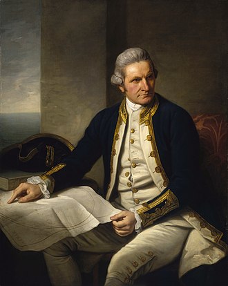
In the 1400s and 1500s, sailors rounded the Cape of Good Hope and Cape Horn, showing that if the unknown southern land existed, it would be its own continent. In 1773, explorer James Cook and his team were the first to cross the Antarctic Circle, though they did not actually see the continent.
Real exploration began when William Smith found the South Shetland Islands by accident in 1819. Soon after, many ships, including ones from the British Empire and the First Russian Antarctic Expedition, visited the area. By 1840, three leaders—Charles Wilkes, Jules Dumont d'Urville, and James Clark Ross—proved Antarctica was a real continent.
Later, famous explorers like Roald Amundsen and Robert Falcon Scott raced to the South Pole. Amundsen reached it first in 1911. In the 1950s, scientists built important permanent bases like McMurdo.
Today, Antarctica is governed by the Antarctic Treaty System, created during the International Geophysical Year, which helps countries work together peacefully there.
Early exploration
The search for Terra Australis Incognita
Main article: Terra Australis
Aristotle wondered about a land far to the south. Long before anyone saw Antarctica, explorers thought there was a big land called Terra Australis Incognita ("Unknown Southern Land") in the far south.
As ships sailed around Africa and South America, they found the southern oceans full of ice and cold winds. Some early sailors thought they saw mountains or land through the fog and snow, but they were not sure.
South of the Antarctic Convergence
In 1675, an English sailor named Anthony de la Roché became one of the first people to spot land south of a special ocean line called the Antarctic Convergence. He saw a rocky island that was later named after him.
In 1773, a famous explorer named James Cook crossed a very important line called the Antarctic Circle. This was the first time anyone had sailed through this icy boundary.
The Antarctic Circle
James Cook and his crew sailed far into the southern waters in the 1770s. They crossed the Antarctic Circle three times and went farther south than anyone before them. They reached a point more than 70 degrees south, where the ice was too thick to go further. Cook wrote about seeing icy seas and snow-covered lands, but he never saw the continent of Antarctica itself.
Discovery of the South Shetland Islands (1819)
In 1819, a sailor named William Smith noticed a group of islands far to the south while his ship was blown off course. These islands, later called the South Shetland Islands, were the first pieces of land ever found in the Antarctic area.
First sighting of the continent (1820)
In January 1820, a Russian expedition led by Fabian Gottlieb von Bellingshausen and Mikhail Lazarev became the first to see what we now know was part of the Antarctic continent. They spotted a distant, icy shoreline through the thick Antarctic fog and snow.
Early exploration
Soon after the South Shetland Islands were found, many ships began visiting the area to hunt seals. These voyages helped map more of the southern lands. In 1821, a sailor named John Davis is believed to have been the first person to step onto the actual continent of Antarctica.
In the years that followed, several famous explorers added more pieces to the puzzle of Antarctica. French explorer Jules Dumont d'Urville and American explorer Charles Wilkes both claimed to have been the first to see parts of the continent in 1840. British explorer James Clark Ross sailed along a huge wall of ice now called the Ross Ice Shelf and discovered active volcanoes buried under the snow and ice.
Heroic Age of Antarctic Exploration
The first recorded landing on the mainland of East Antarctica was at Victoria Land by the American sealer Mercator Cooper on 26 January 1853.
The Heroic Age of Antarctic Exploration began at the end of the 19th century and ended with Ernest Shackleton's Imperial Trans-Antarctic Expedition in 1917.
During this time, many countries sent teams to explore Antarctica. These teams made important discoveries about the land and its wildlife. They traveled in harsh conditions and faced many challenges.
Origins
An early trip that helped start this age of exploration was the Dundee Antarctic Expedition of 1892-93. Four ships from Dundee went south to find whales. They brought scientists and artists, and their stories and pictures made people very interested in Antarctica again. The ships also helped decide where to build a new research vessel called the RRS Discovery in Dundee.
After that trip, a talk by Dr John Murray to the Royal Geographical Society in London on 27 November 1893 encouraged more exploration. Murray said that scientists should organize research to answer questions about the south. The Royal Geographical Society had already created an Antarctic Committee in 1887, which helped whalers explore southern areas and prepared the way for Murray's talk.
The Norwegian ship Antarctic landed at Cape Adare on 24 January 1895.
In August 1895, a big meeting of geographers in London asked scientists around the world to support Antarctic exploration. This would add to many areas of science. The meeting was addressed by Norwegian Carsten Borchgrevink, who had just returned from a whaling trip where he was one of the first people to step onto the Antarctic mainland. During his talk, Borchgrevink talked about plans for a big Antarctic trip, starting at Cape Adare.
The Heroic Age began with an expedition by the Belgian Geographical Society in 1897; Borchgrevink started his own British trip a year later. (Some histories say the Discovery trip, which left in 1901, was the first real trip of the Heroic Age.)
The Belgian Antarctic Expedition was led by Belgian Adrian de Gerlache. In 1898, they became the first people to spend winter in Antarctica, when their ship Belgica got stuck in the ice. They were trapped from 28 February 1898 until 14 March 1899.
During their time stuck, some of the men had health problems because of the dark winter and hard conditions. This was the first trip to spend the winter inside the Antarctic Circle, and they visited the South Shetland Islands.
Early British expeditions
The Southern Cross Expedition started in 1898 and lasted two years. They used the ship SS Southern Cross. This was the first trip to spend winter on the Antarctic mainland (Cape Adare) and the first to use dogs and sleds. They made the first climb of The Great Ice Barrier, later called the Ross Ice Shelf. The trip set a new farthest south record at 78°30'S. They also found the location of the South Magnetic Pole.
The Discovery Expedition happened from 1901 to 1904 and was led by Robert Falcon Scott. They made the first climb of the Western Mountains in Victoria Land, and found the polar plateau. Their southern trip set a new farthest south record, 82°17'S. They discovered and named many geographical features. This was the first of several trips based in McMurdo Sound.
A year later, the Scottish National Antarctic Expedition was started by William Speirs Bruce. They set up 'Ormond House' as a weather research station on Laurie Island in the South Orkneys, the first permanent base in Antarctica. They went into the Weddell Sea to 74°01'S, and found the coast of Coats Land, showing the sea's eastern limits.
Ernest Shackleton, who had been part of Scott's trip, organized and led the Nimrod Expedition from 1907 to 1909. The main goal was to reach the South Pole. Based in McMurdo Sound, the trip opened the Beardmore Glacier route to the South Pole, and used motorised vehicles for the first time. Their southern travel reached 88°23'S, a new farthest south record just 97 geographical miles from the Pole before they had to turn back. During the trip, Shackleton was the first to reach the polar plateau. Teams led by T. W. Edgeworth David also climbed Mount Erebus and reached the South Magnetic Pole.
Expeditions from other countries
The First German Antarctic Expedition in 1901 explored eastern Antarctica. They found the coast of Kaiser Wilhelm II Land, and Mount Gauss. However, their ship got stuck in ice, which stopped more exploration.
The Swedish Antarctic Expedition, happening at the same time, worked on the east coast of Graham Land. Their ship sank, and they were stuck on Snow Hill Island and Paulet Island in the Weddell Sea. They were saved by an Argentinian naval ship called Uruguay.
France sent its first expedition in 1903 under Jean-Baptiste Charcot. It was meant to help a stranded group, but instead they mapped islands and the western coasts of Graham Land on the Antarctic Peninsula. They explored part of the coast and named it Loubet Land after the President of France.
A follow-up trip from 1908 to 1910 continued this work with general exploration of the Bellingshausen Sea, finding islands and other features, including Marguerite Bay, Charcot Island, Renaud Island, Mikkelsen Bay, Rothschild Island.
Race to the South Pole
Main articles: Terra Nova Expedition and Amundsen's South Pole expedition
The big goal of the Heroic Age was to reach the South Pole. Two trips started in 1910 to reach this goal; a group led by Norwegian Polar explorer Roald Amundsen on the ship Fram and Robert Falcon Scott's British group on the Terra Nova.
Amundsen reached the Pole on 14 December 1911 using a route from the Bay of Whales to the polar plateau through the Axel Heiberg Glacier.
Scott and his four friends reached the South Pole through the Beardmore route on 17 January 1912, 33 days after Amundsen.
Further expeditions
The Australasian Antarctic Expedition happened between 1911–1914 and was led by Sir Douglas Mawson. It studied the coastline between Cape Adare and Mount Gauss, mapping and surveying coastal and inland areas.
They found Commonwealth Bay, Ninnis Glacier, Mertz Glacier, and Queen Mary Land. They made big discoveries in geology, ice studies, and land biology.
The Imperial Trans-Antarctic Expedition of 1914–1917 was led by Ernest Shackleton and planned to cross the continent through the South Pole. However, their ship, the Endurance, got trapped and crushed by ice in the Weddell Sea before they could land. The team survived by traveling on sleds over ice, drifting on an ice-floe, and sailing in three small boats to Elephant Island. Then Shackleton and five others sailed across the Southern Ocean in a small boat called James Caird and made the first crossing of South Georgia to alert people at the whaling station Grytviken.
A related part of the Trans-Antarctic Expedition was the Ross Sea party, led by Aeneas Mackintosh. Their job was to set up supply points across the Great Ice Barrier for Shackleton's group crossing from the Weddell Sea. They set up all the needed points, but during this three men, including the leader Mackintosh, died.
Shackleton's last trip, closing the 'Heroic Age,' was the Shackleton–Rowett Expedition from 1921 to 1922 on the ship Quest. Its goals were to map coasts, possibly go around the continent, study islands near Antarctica, and do ocean research. After Shackleton died on 5 January 1922, Quest finished a shorter program before going home.
Further exploration
By air
After the last trip led by Shackleton, people stopped exploring Antarctica for about seven years. In 1929, they started using airplanes and machines more. This time is called the "Mechanical Age." An explorer named Hubert Wilkins first went to Antarctica in the early 1920s. In 1928, he and a pilot named Carl Ben Eielson flew across the Arctic in an airplane.
Wilkins later flew over Antarctica in a plane called the San Francisco, naming a place Hearst Land after the person who paid for his trip. Another explorer, Richard Evelyn Byrd, led many trips to Antarctica in the 1930s, 1940s, and 1950s. He was the first to fly over the South Pole in 1929. Captain Finn Ronne also led a trip and showed that Antarctica is one big continent, not two smaller ones.
Overland crossing
Main article: Commonwealth Trans-Antarctic Expedition
From 1955 to 1958, people made the first big trip across Antarctica. It was led by Dr Vivian Fuchs, with help from Sir Edmund Hillary and his team. Fuchs and his team traveled across the continent in special vehicles, doing science along the way. At the same time, Hillary's team set up a base called Scott Base and helped prepare the route. Hillary's team reached the South Pole on January 3, 1958, and Fuchs' team reached it on January 19, 1958. Fuchs then continued and reached Scott Base on March 2, finishing the first trip across Antarctica.
Political history
Spanish claims
Argentina and Chile believe the Spanish Empire had claims on Antarctica. In 1539, the King of Spain, Charles V, gave a leader a position that included all lands south of the Straits of Magellan, such as Terra Australis and Tierra del Fuego. This may have included all of Antarctica. The borders were set by agreements called the Treaty of Tordesillas and Zaragoza.
The leader passed the title to another leader in 1540. By 1555, the claim became part of Chile.
This means, according to Argentina and Chile, that Spain wanted to control Antarctica. Spain's claim to parts of Antarctica was recognized by Chile and Argentina through old agreements. Each country now claims a part of Antarctica that is south of their lands that face Antarctica.
Today, Spain does not claim any part of Antarctica. It operates two research stations on the South Shetland Islands.
British claims
The United Kingdom kept control of the Falkland Islands in 1833 and kept people there. In 1908, Britain expanded its control to include areas such as South Georgia, the South Orkneys, the South Shetlands, the Sandwich Islands, and Graham's Land. These areas lie south of the 50th parallel of south latitude and between the 20th and 80th degrees of west longitude. The reason was to better manage and tax the whaling industry.
In 1917, the claim was updated to clearly include all land up to the South Pole. This included all islands and lands between the 20th and 50th degrees west longitude south of the 50th parallel, and between the 50th and 80th degrees west longitude south of the 58th parallel of south latitude.
Britain tried to include the whole continent in its empire. In 1923, Britain defined new borders for the Ross Dependency, which is land between the 160th degree east longitude and the 150th degree west longitude south of the 60th parallel.
In 1930, Britain claimed Enderby Land. In 1933, Britain gave land south of 60° S and between 160° E and 45° E to Australia as the Australian Antarctic Territory.
After a law passed in 1931, Britain no longer controlled New Zealand and Australia, but this did not change Britain's role as leader of the Antarctic lands.
Other European claims
France, worried about these claims, declared control over a part of the continent in 1924. This was based on a coastline discovered in 1840 by French explorer Jules Dumont d'Urville, named after his wife, Adèle. Britain later agreed to this claim, and the border between this area and the Australian Antarctic Territory was set in 1938.
Norwegian whalers did not want to pay British taxes and wanted to avoid being left out of the continent commercially. A Norwegian owner financed trips to Antarctica to claim land for Norway and set up stations there for better rights. In 1929, a trip led by Nils Larsen and Ola Olstad landed on Peter I Island and claimed it for Norway. In 1931, a royal proclamation made it a Norwegian area. In 1933, it became a dependency.
In 1929, a trip led by Hjalmar Riiser-Larsen and Finn Lützow-Holm named the land near the island Queen Maud Land after the Norwegian queen Maud of Wales. More exploration happened during a trip from 1930 to 1931. In 1938, talks with Britain set the western border of Queen Maud Land at 20°W.
Norway's claim was challenged by Nazi Germany, which sent a trip in 1938 to fly over as much of it as possible. The ship Schwabenland reached the ice near Antarctica in January 1939. During the trip, an area of about 350,000 square kilometres was photographed from the air. Germany tried to claim this area, called New Swabia, but lost any claim after losing the Second World War.
On January 14, 1939, just before the German arrival, Norway took control of Queen Maud Land after a royal decree announced that the land bordering the Falkland Islands to the west and the Australian Antarctic Dependency to the east would be under Norwegian control. The main reason was to protect Norway's whaling industry's access to the area. In 1948, Norway and Britain agreed to limit Queen Maud Land to between 20°W and 45°E, and to include the Bruce Coast and Coats Land in Norwegian territory.
South American involvement
The nearby South American countries, Argentina and Chile, were worried about these claims by other countries.
In 1831, Chile's leader Bernardo O'Higgins wrote to the Royal Navy saying Chile's area extended from the Mejillones Bay to New South Shetland and from San Jose Peninsula to New South Shetland.
In 1892, Chile made rules to control fishing of seals, sea lions, and other animals. Leases and permissions were given for islands south of Cape Horn. Some people who asked for these were Pedro Pablo Benavides, Lujes Koenigswerther, José Pasinovich, Domingo Toro Herrera, and Enrique Fabry. A rule in 1893 banned hunting and fishing for one year. Later in 1893, the government extended the ban for four more years. In 1894, control over fishing and hunting south of 54 degrees south was given to the Punta Arenas Municipality.
In 1895 and 1896, the Chilean Navy began studying Antarctica after hearing from captains of whaling and merchant ships. Otto Nordenskjöld shared plans to travel to the South Shetland Islands in 1896–1897 with a group in Chile, but these plans did not happen.
Starting in 1903, Chilean whalers visited Deception Island, led by a Norwegian captain under the Chilean flag.
In 1906, Chile approved rules for the Magellan Whaling Company organized by Captain Andresen and Pedro A. de Bruyne. They had been operating in Whalers Bay of Deception with the factory ship Gobernador Bories. Other whaling companies followed, such as the Corral Whaling Society and the Magallanes Fishing Company, which had several hundred people living in Deception during Antarctic summers and operated until World War I. That same year, Chile mentioned that the borders of Chilean Antarctic territory would be investigated. Also, Chile created an Antarctic Commission to organize the first Chilean Antarctic Expedition and build a weather station, but the 1906 Valparaíso earthquake stopped the project from getting money. On June 10, 1907, Argentina formally objected and asked for both countries to recognize each other's Antarctic areas. Work began on a treaty to define the territories more clearly, but it was never signed.
In 1908, a British ship called Telefon ran aground near King George Island in the South Shetland Islands and was left behind by its crew. When Captain Andresen aboard the Chilean whaler Almirante Valenzuela arrived, he raised the Chilean flag and claimed it under maritime law. He towed the ship to Deception Island for repairs. The following spring, the ship Gobernador Bories fixed the Telefon and it sailed again under the Chilean flag. The whaling group bought the Telefon from Lloyds company in 1910 after the accident.
In 1904, Argentina began occupying the area by buying a weather station on Laurie Island set up in 1903 by Dr William S. Bruce's Scottish National Antarctic Expedition. Bruce agreed to sell the station and tools for 5,000 pesos if the government agreed to keep doing science there. A British officer also agreed to these terms.
In 1906, Argentina told others about setting up a permanent base on the South Orkney Islands. But a British officer reminded Argentina that the South Orkneys belonged to Britain. Britain said Argentine workers could stay only for one year. Argentina talked with Britain in 1913 about possibly moving the island. These talks failed, but Argentina tried to show its control by putting up markers, flags, and other symbols.
In 1914, explorer Ernest Shackleton began a trip to reach the South Pole from the Weddell Sea to the Ross Sea. His ship Endurance got stuck in ice and was crushed. Shackleton and his team moved across the frozen sea to open water and reached Elephant Island at the northern tip of the Antarctic peninsula. Shackleton and some others sailed to South Georgia Island to get help. But three tries to reach the rest of the team on Elephant Island failed because of ice. Finally, in Punta Arenas, Shackleton got help from a Chilean navy ship called Yelcho, led by Luis Pardo Villalón, which rescued the remaining team members. On September 4, 1916, they were welcomed in Punta Arenas as heroes. Captain Pardo's journey in very cold temperatures and icy seas earned him recognition. On January 14, 1939, Norway announced claims on Antarctic land between 0° and 20° (Queen Maud Land). This worried Chile, leading President Pedro Aguirre Cerda to push for defining Chile's National Antarctic Territory. A group was organized to look at Norway's interests and Chile's rights, led by Julio Escudero Guzmán. On April 1, 1940, a Chilean commander said Chile's borders in Antarctica should be stated clearly soon.
Taking advantage of World War II in Europe, Chile's president, Pedro Aguirre Cerda, declared the Chilean Antarctic Territory based on an idea called uti possidetis juris, which connected it to old Spanish claims passed to the Governorate of Chile in 1555. The Chilean group, with Julio Escudero's help, set the borders using geography, history, law, and diplomacy. These were made official by a rule on November 6, 1940, and published on June 21, 1955. Some writers say Chile avoided including the South Orkney Islands to respect Argentina's possible claim, but most calculations put the Tordesillas line west of these islands. Argentina objected to Chile's rule in a note on November 12, 1940, saying it did not agree and might claim a similar area. In the 20th Century, these areas were claimed by Britain.
In response to this and earlier German exploration, Britain and its government started Operation Tabarin in 1943 to show Britain's control and set up a permanent presence in Antarctica. This was also because of worries in the government about what the United States might do after the war.
In June 1939, Argentina set up a temporary group to join the International Polar Conference in Norway in 1940. On April 30, 1940 a permanent National Antarctic Commission was created, leading to a claim on the Antarctic mainland. Argentina showed a map in October 1941 with "the Antarctic Sector where Argentina has rights" between 75° W and 25° W, south of 60° S, without formally claiming it yet. In January 1942, Argentina declared its rights between 25° and 68° 34' W, south of 60° S, creating the Argentine Antarctica. On September 2, 1946, a rule said all national maps must show the claimed Argentine Antarctic Sector between 25° and 74° west longitude, south of 60° S. On February 28, 1957, another rule restated the claim between 25° and 74° West and south of 60° South. This area overlaps partly with Britain's claim (20°W to 80°W) and Chile's earlier claim (53°W to 90°W).
In 1943, British workers from HMS Carnarvon Castle took down Argentine flags from Deception Island. The trip was led by Lieutenant James Marr and left the Falkland Islands in two ships, HMS William Scoresby and Fitzroy, on January 29, 1944.
Bases were set up in February near a former Norwegian whaling station on Deception Island, where the British flag was raised instead of Argentine flags, and at Port Lockroy on February 11 on the coast of Graham Land. Another base was started at Hope Bay on February 13, 1945, after an earlier try failed on February 7, 1944. Signs of British control, like post offices, signs and plaques were put up and postage stamps were made.
Operation Tabarin led Chile to start its First Chilean Antarctic Expedition in 1947–48, where Chile's president Gabriel González Videla opened Base General Bernardo O'Higgins Riquelme himself.
After the war ended in 1945, the British bases were given to civilian workers from the new Falkland Islands Dependencies Survey (later the British Antarctic Survey), the first national science group in Antarctica.
Politics over Antarctica and control of paths between the south Atlantic and south Pacific led to the creation of cities like Ushuaia and Puerto Williams, both claiming to be the southernmost cities.
In the late 1940s, Argentina and Chile said they agreed on each other's claims, saying "Chile and Argentina have clear rights of control in the area called American Antarctica."
On March 4, 1948, Chile and Argentina signed an agreement about Antarctica. It said:
(...) until agreed by both, the line between Chile and Argentina in Antarctic areas of Chile and Argentina, declared:
- That both governments working together on legal protection and defense of their rights in American Antarctica, between the meridians 25° and 90° west longitude of Greenwich, Chile and Argentina recognize each other's undisputed sovereign rights.
Today, all three countries — Chile, Argentina, and Britain — have research stations in Antarctica, and all three claim the whole Antarctic Peninsula.
Post-war developments
Problems between Britain and Latin American countries continued after the war. British navy ships were sent in 1948 to stop naval attacks and in 1952, an Argentine team at Hope Bay (Britain's Base "D" set up in 1945) pointed a machine gun at a British Antarctic Survey team bringing supplies from the John Biscoe. The Argentines later said sorry, saying it was a misunderstanding and the Argentine military leader there went too far.
The United States became interested in Antarctica before and during World War II. The United States Antarctic Service Expedition, from 1939 to 1941, was paid for by the government with extra help from private people, companies and groups. President Franklin D. Roosevelt wanted two bases set up: East Base near Charcot Island, and West Base near King Edward VII Land. After working for two years, with tensions rising, it was decided to leave the two bases.
But after the war, the United States became interested again, but this time for politics. Operation Highjump, from 1946 to 1947 was led by Rear Admiral Richard E. Byrd Jr. It had 4,700 people, 13 ships, and many planes. The main goal was to set up the Antarctic research base Little America IV, to train people and test tools in very cold weather and to learn more about conditions such as water, geography, rocks, weather, and radio signals in the area. The goal was also to make the United States control as much of the Antarctic continent as possible, though this was denied publicly even before the trip ended.
Towards an international treaty
Meanwhile, to try to end the argument, Britain asked the International Court of Justice on May 4, 1955 to decide between the area claims of Britain, Argentina and Chile, saying the claims of Argentina and Chile were not valid. This suggestion failed because both Argentina and Chile refused to go to an international court. On July 15, 1955, Chile said it would not accept the Court's decision, and on August 1, Argentina did the same. So, on March 16, 1956 claims were made.
A law from June 17, 1955 added the Chilean Antarctic Territory to the Province of Magallanes, which became the Region of Magallanes and Chilean Antarctica on July 12, 1974.
In 1958, the U.S. president, Dwight Eisenhower, invited Chile to the International Geophysical Year Conference to try to solve the claiming issues.
Talks to create an international shared control of the continent began in 1948 among the 7 countries making claims (Britain, Australia, New Zealand, France, Norway, Chile and Argentina) and the US. This tried to keep the Soviet Union out of the area but quickly failed when the Soviet Union said it wanted to be involved and would not recognize any claims, and kept the right to make its own claims in 1950.
An important step toward the Antarctic Treaty System in 1959 was the International Geophysical Year, 1957–1958. This year of working together on science triggered an 18-month time of strong Antarctic science. More than 70 national science groups created committees for the IGY and took part in the shared effort. Britain set up Halley Research Station in 1956 through a trip by the Royal Society. Sir Vivian Fuchs led the Commonwealth Trans-Antarctic Expedition, which finished the first land trip across Antarctica in 1958. In Japan, the Japan Maritime Safety Agency offered the ice breaker Sōya as the ship for trips to the South Pole and Showa Station was built as the first Japanese base in Antarctica.
France built Dumont d'Urville Station and Charcot Station in Adélie Land. The ship Commandant Charcot from the French Navy spent nine months in 1949/50 on the coast of Adelie Land, doing soundings of the sky. The US built the Amundsen–Scott South Pole Station as the first permanent building at the South Pole in January 1957.
Finally, to stop the chance of fighting in the area, the United States, United Kingdom, the Soviet Union and 9 other countries with big interests talked and signed the Antarctic Treaty in 1959. It started in 1961 and set Antarctica as a place for science, allowed free scientific work and stopped military activity on that continent. The treaty was the first arms control agreement during the Cold War.
Recent history
A baby named Emilio Marcos de Palma was born near Hope Bay in 1978. He was the first baby born in Antarctica.
In 1991, countries that were part of the Antarctic Treaty agreed to protect Antarctica from mining and drilling. They made a rule that banned any mineral extraction for 50 years. This kept Antarctica a place for peace and science.
Børge Ousland, a Norwegian explorer, completed the first solo crossing of Antarctica without any help in 1997.
On 23 November 2007, the ship MV Explorer hit an iceberg and sank, but everyone on board was safely rescued by nearby ships.
In 2010, the IceCube Neutrino Observatory was finished. In 2013, it was reported that the observatory had detected 28 neutrinos that came from outside the Solar System.
Women in Antarctica
Main article: Women in Antarctica
For a long time, women were not allowed to explore Antarctica. A few brave women, like Louise Séguin and Ingrid Christensen, were among the first to see the waters around Antarctica. Christensen was the first woman to step on the mainland of Antarctica. In 1935, Caroline Mikkelsen became the first woman to set foot on an island in Antarctica. Later, in 1947, Jackie Ronne and Jennie Darlington were the first women to spend the winter in Antarctica. The first woman scientist to work there was Maria Klenova in 1956. In 1978, Silvia Morella de Palma became the first woman to have a baby in Antarctica.
For many years, women faced unfair rules that kept them from going to Antarctica or doing research there. Until 1969, American women were not allowed to travel to Antarctica at all. Some people believed women could not handle the cold or difficult situations. Even after women were allowed to go, they still faced unfair treatment. But by the mid-1990s, things began to change, and more and more women started working and researching in Antarctica.
Images
Related articles


This article is a child-friendly adaptation of the Wikipedia article on History of Antarctica, available under CC BY-SA 4.0.
Images from Wikimedia Commons. Tap any image to view credits and license.