 Safekipedia
Transport in the Netherlands
Adapted from Wikipedia · Adventurer experience
The Netherlands is a busy country where people need to travel a lot for work and daily life. It has many roads, railways, airports, and waterways to help people and goods move around quickly.
The country has a lot of roads, including special roads for fast travel. It also has good train services that connect towns and cities. The Netherlands is well-known for its cycling infrastructure, with many bike lanes separate from car traffic.
The port of Rotterdam is one of the biggest ports in the world. It connects to many countries through rivers like the Rhine and Meuse. Amsterdam is also a very busy port. People in the Netherlands use many ways to travel: cars, bikes, walking, and public transport. Dutch airports are busy places too. Each day, people in the Netherlands travel a good distance to get where they need to go.
Road transport
Main article: Road transport in the Netherlands
The Netherlands has many roads, covering 139,000 km in total. This includes 3,530 km of motorways and expressways, making it one of the densest motorway systems in the world. Most of these roads are national roads, with some important provincial roads as well.
People in the Netherlands use their roads a lot. Over 200 billion kilometres are travelled each year, mostly by car. Even though there are many roads, they can get busy, especially around big cities like the Randstad area. To help with traffic, the country uses special signs and signals on its motorways to manage the flow of vehicles.
Cycling
Main article: Cycling in the Netherlands
Cycling is a very common way to travel in the Netherlands. Many people use bikes for everyday trips. Almost everyone owns at least one bicycle. There are thought to be more than 18 million bikes in the country.
The roads and paths for bikes are very good and easy to use. Most roads let cyclists ride along, and there are special paths just for bikes. In busy places, bikes often get special traffic lights to keep things safe.
There are also big places to park bikes, especially in cities and near train stations. Many train passengers ride their bikes to get to the station.
In 2013, a group called the European Cyclists' Federation said the Netherlands, along with Denmark, was one of the best countries in Europe for cycling.
Rail transport
Main articles: Rail transport in the Netherlands and Dutch railway services
The Netherlands has a very busy railway system. Most people use trains to travel around the country. The rail network has many miles of tracks, and most of them have electricity to power the trains. There are many train stations, and they connect almost every town and city.
Trains run often. On busy days, some stations have trains leaving every few minutes. The biggest stations in Amsterdam, Rotterdam, The Hague, and Utrecht have been updated and made bigger in recent years. The Dutch rail system is known for being efficient and busy, with many people using it every day.
Future developments
Two groups in Europe started a project to make planning trains better. This will help freight and passenger trains work together more smoothly. In the future, adding more tracks or changing some lines to work like subways could help even more people travel. But for now, there are no big plans for these changes.
Public transport
Main article: Public transport in the Netherlands
Trains are the main way to travel long distances in the Netherlands. Some places without train tracks use buses instead. In smaller towns and rural areas, buses are the main way to get around. In big cities like Amsterdam, Rotterdam, and The Hague, there are also trams that connect these cities with nearby areas.
Amsterdam and Rotterdam also have metro, or subway, lines. Amsterdam added a new "North-South" line in July 2018 after many years of work.
Rotterdam, The Hague, and the areas between them are linked by a light rail system called RandstadRail. One of the Rotterdam metro lines goes all the way to The Hague Central station. Utrecht has its own light rail system that connects the city to nearby places like Nieuwegein and IJsselstein. Arnhem still runs a trolleybus system.
Because the Netherlands has many waterways, some places are connected by ferries instead of roads. In the Rotterdam and -Drecht towns area, there is also a water bus service.
Public transport is run by both local government companies and private companies.
Air travel
See also: List of airports in the Netherlands and List of airlines of the Netherlands
Air travel in the Netherlands is very popular.
Amsterdam Schiphol Airport, near Amsterdam, is the biggest international airport in the country. It has flights to many places around the world. Many airlines use Schiphol, including KLM and its regional service KLM Cityhopper, as well as Corendon Dutch Airlines, Martinair, Transavia, and TUI Airlines Netherlands. It is also used by airlines such as Delta Air Lines, EasyJet, and Vueling.
Other airports in the Netherlands, like Eindhoven Airport, Rotterdam The Hague Airport, Maastricht Aachen Airport, and Groningen Airport, are smaller but help people travel too.
Water transport
Ports and harbours
The Netherlands has thirteen seaports, and three of them are very important for trade around the world. The port of Rotterdam is the biggest port in Europe and one of the biggest in the world. The Amsterdam seaport is the second biggest in the country. The ports of Vlissingen and Terneuzen work together as Zeeland Seaports and are also very busy.
Rotterdam is close to important places because of the Rhine and Meuse rivers, which reach countries like Germany, France, and Switzerland. The port helps move goods by ship, barge, train, or road. A fast freight railway called the Betuweroute was built to connect Rotterdam to Germany.
The Netherlands has a big fleet of ships, and many kinds of ships are used to carry different goods.
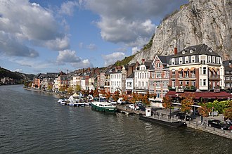
The country has many rivers and canals used for transportation. Lots of ships travel these waterways, carrying many goods, especially big amounts of materials. Many important places can be reached by water using special ports and terminals.
Pipelines
Pipeline transport moves things like oil and gas through tubes. The Netherlands has pipelines for crude oil that are 418 km long and for petroleum products that are 965 km long.
The country also has a good network for moving natural gas. This network has 12,200 km of big pipes for sending gas far away and 136,400 km of smaller pipes for bringing it closer to homes. Experts think these pipes could also be used to move hydrogen in the future.
Natural gas pipes are looked after by a company called Gasunie Transport Services (GTS). They connect places where gas is made, stored, and used. There are two kinds of gas pipes: one for homes and another for factories and power plants.
Oil pipes carry crude oil from the Port of Rotterdam to places where it is made into other products in the Netherlands, Belgium, and Germany. There are also pipes that move different materials between factories. One special system moves clean CO2 from factories to greenhouses to help plants grow better in the Westland area.
Government
Transport in the Netherlands is managed by the Ministry of Infrastructure and Water Management. For public transport, 14 groups decide which companies can run buses and trams. These groups include the twelve provinces and special areas around Amsterdam and Rotterdam/The Hague. They all work together in a group called DOVA, which stands for Decentralised Public Transport Authorities.
Roads in the Netherlands are controlled by different groups. The national government manages about 5,200 km of major roads through Rijkswaterstaat. The twelve provinces manage about 7,800 km of important regional roads. Most big highways are national roads, while provincial roads are shorter and serve local areas.
Municipal roads make up most of the network, with around 120,000 km of local streets. The Netherlands is also split into 21 water management boards, which along with other groups control another 7,500 km of roads. Some of these roads are part of important water barriers like dikes and dams, and others give access to key water control structures.
Economics
Transport is very important for the economy of the Netherlands. Jobs in moving goods and storing them helped many people work. These jobs brought in a lot of money.
Images
Related articles


This article is a child-friendly adaptation of the Wikipedia article on Transport in the Netherlands, available under CC BY-SA 4.0.
Images from Wikimedia Commons. Tap any image to view credits and license.